Showing posts with label Technology Handheld GPS receivers. Show all posts

Sunday, 10 May 2015

Uploading vector layers from QGIS and store in GPS receiver (USB Port) using DNR GPS


 YouTube Video Link


Overview
This post is what I would like to call the USB route to uploading GPX layers from QGIS into a USB Port GPS receiver.
Note-
- The GPS receiver- Garmin Dakota series- comes with only USB Port. If your receiver comes with a serial com port, you can do the upload direct without going through DNR GPS.
- Apart from converting files, DNR GPS also serves as an upload vehicle for GPS receivers.
- The DNR GPS is not acting as a converter in this procedure but an upload vehicle.
- In QGIS, one can digitize layers on the image using GPX file format direct.

Task
We want to create and upload layers (point, line and polygon) from QGIS and store as waypoints, route and track in our GPS receivers. Steps to follow- (a) Trace out waypoint, route and track layers on the image in QGIS; b) Upload to the GPS receiver using DNR GPS.
Note- One can save it straight into the GPX folder in the drive of the receiver but this denies one the opportunity that DNRGPS offers, which is, viewing the contents of the GPX file before upload.

Procedure
1. Launch QGIS. Go to Layer>Create new layer>Create new GPX layer.
2

2. Digitize waypoint, route and track features (point, line and polygon) on the image. The waypoints are in red, the route in purple and the track in yellow. Make sure the layers are properly saved after digitizing.
12

3. Launch DNR GPS. Go to File>Load from>File. Navigate to the folder where the gpx file was saved. Open the gpx file from the working folder. A message box will show indicating the file has been successfully loaded.
pix 5

4. Click on Waypoints and the waypoints created in QGIS will appear. Take a good look at the Tracks(red boxed) and Route buttons(green boxed). Note that the tracks and routes that were created were also uploaded together with the waypoints. Click on them to check the contents.
15

5. Go to Track and click Upload. Do the same for route and Waypoint. A message box saying Upload Complete indicates the file has been uploaded to the GPS receiver.
Capture-2


6. Disconnect the GPS receiver and check for the uploaded waypoints, route and track.
TrackRouteWaypoints_001

Hope you are already practicing with the QGIS. Feel free to send your feedback and comments.

Tip- you can double click on the images and it will open in a new window in a larger size.

Monday, 4 May 2015

Uploading data in excel spreadsheet into a GPS receiver

Document1-001

A lot of field work data is reported in the form of tables and spreadsheets. A field staff will normally document his or her field data in excel tables and then file them in with the report. Therefore, it is usually the first source to retrieve locational data from. We will be demonstrating this process using the DNR GPS software as an intermediary to do the conversion to GPX files as well as to upload the data into the GPS receiver.

Task
In this demonstration, we will do the following:
- Save Excel data in a format that DNR GPS will recognize- Text Tab delimited.
- Convert using DNR GPS to GPX format
- Upload to the GPS as Waypoints, routes or tracks.

Procedure
1. Launch microsoft Excel. Navigate to where the file is and Open in excel.
1

2. Save type as Text (Tab Delimited)*txt* in the Save as dialog box. Click yes for any prompts that pop up during the process.
2

3. Launch DNR GPS. File > Load From>File (red boxed). Navigate to the Text file just created.
3

4. Open it and it will load into DNR GPS.
4

5. File > Save To> File. In the Save as dialog box, this time for Save Type as - select from the dropdown list- GPS Xchange file *gpx*
5

6. Select Waypoints, tracks or routes as is appropriate. For this demo, waypoint is selected.
6

7. Connect the GPS receiver, go to Waypoints> Upload. It will prompt for the name, fill the name and OK. The Upload complete message box will show.
7

8. Disconnect the GPS receiver and check the GPX folder in the Garmin drive for the waypoints.

How to Check the Garmin GPS receiver for GPX files
Go to the Drive on your computer- Garmin Drive E
Open the drive and Click on the Garmin Folder
In the Garmin Folder, locate the GPX folder
Open the folder and look for the uploaded file.

Sunday, 19 April 2015

Downloading data from the handheld GPS receiver using DNRGPS software


Downloading data from the GPS after use on the field can be a very fulfilling task. After sweating it out to meticulously collect spatial and non-spatial data on the field, it is quite relaxing to be able to view, process and file away the data for future work.
Most GPS receivers today have proprietary download software, such as Basecamp for Garmin and Vantage Point for Magellan. I have used a couple of them and found that converting GPS data from the format in the GPS – (usually in the GPS Xchange Format *.Gpx) to other formats can be tasking without the right tools.
So a few years ago I discovered a powerful non-proprietary middle man known then as the DNR GARMIN. DNR GARMIN is a product of the Department of Natural Resources, Minnesota and then could only work with Garmin receivers. However with subsequent versions, of which the DNR GPS 6.0 series is the latest, it is adapted to other brands of receivers,as long as the native format of the data is stored as GPX format. DNR GPS is free and has a download size of about 40mb.
DNRGPS will do the following for us in this post-
  • Conversion of GPS data to Spreadsheet form is much easier and direct using the Text Tab delimited format *.txt;
  • Converting GPS data to projected and/or unprojected .shp shape files allowing one to create features in both ArcGIS and QGIS seamlessly.
The GPS data for the tutorial is downloaded from a Garmin Dakota 10 and are waypoints. The Garmin Dakota comes with a downloading cable with a USB port.
Click the icon below to download the tutorial and follow the process (same process can be used for routes and track features)


Friday, 17 April 2015

Comparing the level of accuracy of some GPS Enabled devices against the handheld GPS Receiver unit

Often times when I conduct trainings I get asked the question - ‘since our phones have GPS, why the need for this device?’ Over the years, I have consistently done this comparison test many times in the field in order to be sure I was still in tune with reality as technology improves every day.

 What is my objective- To find out how accurate GPS enabled smartphones outfitted with location tracking software could be against the regular handheld GPS receiver unit?

My tools of the trade – a) a Blackberry Z10 running on Google AppSheet mobile location tracking app called ZipStore b) An IPhone running the ESRI proprietary ArcGIS Collector mobile App c) Garmin Dakota 20.
I wasn’t under any presumptions which was the best, so I went out quite sure the Garmin Dakota will better my GPS Enabled devices but the real question was how close or wide the margin will be for these smartphone devices.

Weather conditions- the sky was clear and marked a perfect day for a good mapping experience.

Methodology- at each location, I take the geographic coordinates of that point with each of the devices. The reading is taken on the same spot with each of the devices so there will be a sound basis for comparison. The locations chosen for the mapping have identifiable landmarks, are narrower than wide giving just enough room and margin to highlight the inaccuracies. Each device readings was then downloaded into google maps engine for visualization.

Results – See the embedded google image
Many of the points (shown as red markers) from the ZipStore app hosted on the blackberry Z10 fell off the mark into rather generalized positions. Surprisingly, Points captured using ESRI Collector (show in dark green actually showed a very fair degree of accuracy). While the points captured with the Garmin Dakota 20 when viewed on the imagery showed a near perfect match with the real locations, allowing it to basically serve as a control.

Conclusion- The handheld GPS gave a best showing as expected but the Esri Collector gave a great showing of itself, even rivaling the handheld at a good number of the locations. Esri Collector used base maps downloaded from ArcGIS Online while ZipStore used Bing maps.

Constraints- Most of the Smart phone location apps work with telecom networks for data as storage is cloud based. At location to3, Zip store on the Blackberry Z10 couldn’t acquire location while the Esri Collector started from point to3 downloads and couldn’t participate at to2 and to1 due to slow upload of the base map.

Hope u enjoyed the post, we love your comments.

Thursday, 16 April 2015

Unravelling the common myths spoken about the handheld GPS receiver units


I have been using, selling handheld GPS receivers and training people from many different field and disciplines on how to use them for close to ten years now.Since my first encounter with the GPS many years ago, the handheld GPS receiver unit has always held a technological fascination for me. Even back then before the mobile rush, there was something extra special about been able to use technology on the go. I have come across several comments on these devices and I decided to share some of the most commonly spoken views and impressions.
Number one – Seems its expensive!!
Nowadays, a good mid-range handheld GPS receiver is just as expensive and portable as a mid-range price smart phone. The cheapest Garmin Dakota will easily go for between 100 to 150 dollars in the retail store. An outdoor mapping enthusiasts can save up and purchase this, and mind you, they last far longer than your mobile phones can!
Number Two- I can always use my smart phone inbuilt GPS
This is one of the fastest selling myths.
Firstly, the handheld GPS receiver unit comes with a specialized chipset and processor (SIRF) dedicated to tracking and getting signals or GPS fix from GPS satellites. These devices were built for this singular purposes. On the other hand, your smart phones come fitted for generalized location tracking. Yes I agree they can come in handy but only if supported by specialized location software. Your guess is as good as mine of how many buffs out there will download ArcGIS collector or IDK into their iPad or iPhone? Mapping has its tools, smart phone GPS applications are not designed to map anything more than point features and navigation. They are tailored to the extra specs market not the hard nose recreational user who wants to hike and download tracks.
Secondly, the handheld was designed to manage energy and the demand placed on it by always looking for satellite signals and calculating positions. Most handhelds can last a full day of mapping on a set of AA batteries. A smartphone would be stretched to limit on demand on its battery by such a drain.
Lastly, the smartphone was not designed for rugged outdoor work that you require of your handheld GPS receiver.
 Number Three- I used it only once in a while and that’s it! It goes in the box for another two years!
This tendency is what I will call the facts gone wrong. From my wide experience, many people tend to abandon the handheld GPS receiver once the objective of getting them is achieved, usually this is an office project or training session or fad to keep up with. A handheld GPS receiver can be so much fun to play with if one begins to get creative with it both at work and at home. A simple trekking exercise in the morning with it can help one know his or her usual route and real distance covered. Same also goes for time and the elevation profile of the trek.
We will post that up over the next few days.
 Number Four-I will need some form of advanced training to know how to use it.
Another facts gone haywire. Learning how to use a GPS to do basic functions really is not that expensive nor time consuming. Yes I agree, there are not many trainers out there but we are throwing up a programme soon for outdoor enthusiasts to learn the pros and cons, to help the users achieve a better accuracy and a more credible data for optimal use. We are currently working on stringing up some tips on that, but we want it to be direct feedback. So send in your comments on learning challenges with the handheld GPS and we should be able to give you some answers.
 Number Five- Can I use it to locate my parcel of land and measure the size?
I always remind people- if you are not a trained surveyor, no need to try to be one overnight. Really, with adequate minimal training, one can navigate to that long lost parcel of land and in addition, measure the area and perimeter using a mapping grade handheld GPS receiver unit. Note that the level of accuracy will differ from that of modern high tech survey equipment designed for less than 1m accuracy. We will put up about types, causes of error and how to correct for these errors in a GPS.

Hope you enjoyed the short piece. Let’s have your comments please

Wednesday, 15 April 2015

Handheld GPS Receiver Units- an Essential tool for the Mapping enthusiast

Click link to see images of handheld GPS Units


Handheld Global Positioning System (GPS) receivers are GPS enabled devices that are portable and are adapted for mobile and outdoor activity such as hiking, biking and even some utility mapping. Suffice to say that even some professionals still find them handy and accurate to a specification. They come in many brand names, with many specifications but are generally classified by price into low, mid and top range models. They can also be classified by function into mapping grade, biking, hiking and marine.

These devices have seen a massive improvement in their design, hardware and software specifications. Many of the leading brands such as Magellan and Garmin have gone ahead to develop cloud based platforms as well as imagery download capabilities in their mid-priced ranges. In addition, the brands have led aggressive marketing to promote the appeal of these devices to the less professional and recreational users.

Mapping grade handheld GPS devices usually come with four standard functions namely-Waypoint, Route, Track and Navigation. These functions give the user the tools to represent real life features properly as well as find his or her way around. They come with a base map and enables the user to capture points, lines and calculate area features and view on a map. They store the data that is captured on the field, with some mid-priced ranges able to store 1000 units of data outside of the memory card. Basically the degree and sophistication of functions drive the price tag.

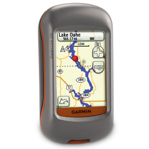
My favourite handheld tool for a while had been the Garmin GPSMAP 78s. It has a rugged feel and a good sized screen, but it is now way behind in the trend of things today. I got a Garmin Dakota 20 recently and it sports a larger screen,touchscreen and has an interface that is easier (at least by me) to input data. In everything, best of all is the price because for some of the power it packs, it comes at a low to mid-price range of between 180 to 220 dollars.

Nowadays, top range handheld GPS receivers are bundled with a variety of additional high tech software and hardware capabilities such as inbuilt cameras, health and ergonomic monitors, cloud based connections, internet sharing and so on. They could cost anything from 800 to 1500 dollars.

Handheld GPS devices are outdoor tools so they are made to be rugged, float on water and weather resistant. Some are equipped with marine charts and this is normally indicated in the marketing prose.

One of the great things about handheld GPS is the ability to download your data after working on a trip, hike or even serious professional activities.  Most of them come with downloading USB cables and proprietary interface software. We will choose a later post to talk more about downloading and uploading GPS data.

Hope you have gotten that bit of basic information on handheld GPS receiver units. Let us have your comments please

Next post, we debate the myths and facts behind the Handheld GPS receiver!!!